| Accident Summary | ||||||||||||||||||||||||||||
| Date | 28 July 2010 | |||||||||||||||||||||||||||
| Summary | Controlled flight into terrain aggravated by inclement weather, pilot error. | |||||||||||||||||||||||||||
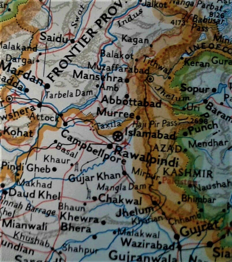
| Site | Margalla Hills, Pakistan; Coordinates: N33°44′23; E73°3′29E | |||||||||||||||||||||||||||
| Passengers | 146 | |||||||||||||||||||||||||||
| Crew | 6 | |||||||||||||||||||||||||||
| Fatalities | 152 (all) | |||||||||||||||||||||||||||
| Survivors | 0 | |||||||||||||||||||||||||||
| Flight origin | Jinnah International Airport, Karachi, Pakistan | |||||||||||||||||||||||||||
| Flight Destination | Benazir Bhutto International Airport, Islamabad, Pakistan | |||||||||||||||||||||||||||
| Operator | Airblue | |||||||||||||||||||||||||||
| Aircraft type | Airbus A321-231 | |||||||||||||||||||||||||||
| Registration | AP-BJB | |||||||||||||||||||||||||||
Airblue Flight ABQ-202 was scheduled to fly a domestic flight sector Karachi – Islamabad. The aircraft had 152 persons on board, including six crew members.
The aircraft took-off from Karachi at 0241 UTC (0741 PST) for Islamabad. At 0441:08, while executing a circling approach for Runway 12 at Islamabad, it flew into Margalla Hills, and crashed at 9.6 NM, on a radial 334 from Islamabad VOR. The aircraft was destroyed and all souls on board the aircraft, sustained fatal injuries.
Cockpit Crew
| Captain | Pervez Iqbal Chaudhry | First Officer | Muntajib Ahmed | Squadron Leader PAF Retd. Ex-F-16 pilot | |||||||||||||||||||||||||
| Nationality | Pakistan | Nationality | Pakistan | ||||||||||||||||||||||||||
| ED Number | 16815 | ED Number | 17238 | ||||||||||||||||||||||||||
| Age | 61 years, 07 months, | Age | 34 years, 11 months, | ||||||||||||||||||||||||||
| Date of initial medical assessment | 10 July 1967 | Date of initial medical assessment | 07 July 2008 | ||||||||||||||||||||||||||
| Date of last medical assessment | 14 June 2010 | Date of last medical assessment | 24 July 2009 | ||||||||||||||||||||||||||
| ATPL # / validity | 462 / 31 March 2011 | CPL # / validity | 2899 / 28 February 2011 | ||||||||||||||||||||||||||
| Rating | A-319/320/321 | Rating | A-319/320/321 | ||||||||||||||||||||||||||
| Date of last simulator check | 29 March 2010 | Date of last simulator check | 6 March 2010 | ||||||||||||||||||||||||||
| Flying experience total | 25497:00 hrs | Flying experience total | 1837:00 hrs | ||||||||||||||||||||||||||
| Flying experience on Airbus A-320 | 1060:00 hrs | Flying experience on Airbus A-320 | 286:00 hrs | ||||||||||||||||||||||||||
| FDTL | In accordance with Regulations | FDTL | In accordance with Regulations |
Both the crew members were adequately experienced, possessed valid licenses, were rated for the type, and medically fit to undertake the flight on 28 July 2010.
Aircraft

Aircraft received from Aero Lloyd
Aircraft Model: A321-231-A5
Manufacturer Serial Number: 1218
Date of Manufacture: 14-04-2000
Date of Induction: 05-02-2006A
ircraft Registration: AP-BJB
Certificate of Airworthiness: valid up to 6 February 2011
Aircraft daily inspection / servicing was carried out on 28 July 2010 prior to the flight ABQ-202 and no defect was recorded. No anomaly in the aircraft system performance was recorded before and during the flight till the aircraft flew into Margalla Hills
Airfield Information
A hilly area lay to the northeast of Benazir Bhutto International Airport (BBIAP), Islamabad. The city of Islamabad is to the North-west and Rawalpindi is to the South-west of the aerodrome. There are 2 prohibited areas near the airport: OP(P)-254 to the southwest and OP(P)-277 to the northeast Islamabad Airport is a joint user airfield. Air Traffic Services (ATS) are provided by CAA and PAF in their respective areas of jurisdiction. Chaklala Tower is manned by PAF to provide aerodrome Control Services, whereas CAA Radar is providing radar vectoring services to arrival and departing aircraft in the designated airspace. Airfield layout includes one main runway with no parallel or usable secondary surfaces
The following is the Jeppesen chart for the ILS DME RWY-30 approach. It also contains the circle-to-land minimums.


Recommended crew actions for circling approach
This diagram shows that a 45° track change is used to leave the final approach course to go and intercept the downwind leg. The time to execute this break-off leg should be 30 seconds, including turns.
According to ICAO document 8168 (PANS-OPS), “the runway environment should be kept in sight while at minimum descent altitude/height (MDA/H) for circling. The runway environment includes features such as the runway threshold or approach lighting aids or other markings identifiable with the runway.”
According to this same document, the Airbus A321 is a category C aircraft. Its maximum speed for visual manoeuvring (circling) is 180 kt. The groundspeed used for the determination of the visual manoeuvring area is based on an ISA+15° temperature, altitude 1,000 feet above the airport elevation and a 25-knot wind. These conditions for Islamabad airport and a category C aircraft give a maximum groundspeed of 220 knot for a circling approach. The maximum distance travelled in 30 seconds is therefore 1.85 NM. 6.6.5 Therefore, the maximum distance between the runway centreline and the downwind leg is 1.3 NM, if the above recommended procedure is followed.
Visual manoeuvring area for Circle to land.
The published circle-to-land MDA is 2,510 feet for category C aircraft. The corresponding visibility is 2,400 m. According to ICAO documentation (DOC 8168), the visual manoeuvring area for a circling approach is determined by drawing arcs centred on each runway threshold and joining those arcs with tangent lines. The radius of the arcs is related to:
- aircraft category (the Airbus A321 is a category C aircraft)
- maximum speed for visual manoeuvring (180 kt for category C aircraft);
- wind speed: 25 knots throughout the turn;
- bank angle: 20° average or 3° per second, whichever requires less bank.
- temperature ISA+15°C
- altitude 1,000 feet above the airport elevation, which is 1,668 feet at BBIAP, Islamabad

Meteorological Information
The weather observation reports (METAR) at BBIAP, Islamabad on 28 July 2010 at various hours is as follows: Time in UTC
Weather Report


Islamabad weather at 0441 (time of crash)
Investigation
The Civil Aviation Authority immediately launched an investigation into the accident. Airbus stated that they would provide full technical assistance to Pakistani authorities. A six-member Airbus team, headed by Nicolas Bardou, the company’s director of flight safety, arrived in Islamabad on 29 July 2010.
The aircraft’s flight recorders were located on 31 July, when Junaid Ameen, the director-general of the Pakistan Civil Aviation Authority, told AFP that “the investigating committee found the black box from the Margalla Hills this morning … the black box was found from the bulk of the wreckage of the crashed plane.” He stated that the box would be examined by “foreign experts” in Germany or France as Pakistan does not possess the equipment to decode the flight recorders. He also stated that the process of extracting information may take six months to a year. The Pakistani authorities decided to send the CVR and FDR to the Bureau d’Enquêtes et d’Analyses pour la Sécurité de l’Aviation Civile (BEA) in France.
Sequence of events leading to the crash
The Pakistan Civil Aviation Authority (PCAA) issued the final report in November 2011. It covered the key events that lead to the crash.
- ABQ-202 was scheduled to fly from Karachi to Islamabad. Start up, push back and taxi remained uneventful and the aircraft took-off from Karachi at 0241:21 UTC (0741:21 hrs-PST). After take-off at 0252:00, crew were served with tea and croissants by cabin crew. During initial climb, the Captain tested the knowledge of First Officer and used harsh words and snobbish tone, contrary to the company procedures/norms. The question / answer sessions, lecturing and advises by the mishap Captain continued with intervals for about one hour after take-off. After the intermittent humiliating sessions, the First Officer generally remained quiet, became under confident, submissive, and subsequently did not challenge the Captain for any of his errors, breaches and violations.
- The crew had listened to the Automatic Terminal Information Service (ATIS) information at about 0350 UTC and were informed that the runway in use at Islamabad airport (OPRN) was Runway 12. At that time, the aircraft was in cruise on a NE heading at FL330, 155 NM from Islamabad. According to DFDR information, the Captain was the Pilot Flying (PF)
- About 2 minutes later at 0352 UTC, the crew discussed waypoints 5 NM to the southwest of the runway, on a radial 206 from OPRN (VOR) which is exactly 90° to the left of the approach course of the ILS procedure to Runway 30.
- The Captain checked weather enroute, Islamabad, Peshawar and Lahore, through ATS and ATIS, and was fully aware about its gravity / intensity. The Captain sounded to be apprehensive about weather. The Captain was heard to be confusing BBIAP Islamabad with JIAP Karachi while planning FMS, and Khanpur Lake (Wah) with Kahuta area during holding pattern.
- After learning that ABQ-202 would be required to execute a visual circling approach for RWY-12, in the reduced visibility and low clouds, Captain prepared himself to fly the visual circling approach on NAV mode. Accordingly, the Captain asked the First Officer to feed unauthorized 04 waypoints (PBD 8 to 11) in the FMS. First Officer did not challenge the Captain for his incorrect actions.
- While planning for right hand downwind of visual approach Runway 12, at 0357:48 the Captain briefed First Officer (FO), “from abeam Runway 30, 3 to 5 miles abeam CF, then we go to abeam CF and then landing”. This was contrary to established procedures for BBIAP, Islamabad.
- In the pre-descent brief, the Captain reaffirmed his stance to go to the end of downwind and then go abeam CF (5 miles) and then turn for landing. During the descent, the Captain’s request for a right-hand downwind Runway 12 for a visual approach (the request being contrary to established procedures at BBIAP) was not agreed to by the Radar due to procedural limitations. The Captain became worried about bad weather and low clouds on the left hand downwind.
03:58:17-aircraft started the descent.
0404:20–the Radar Controller informed ABQ-202 to “expect arrival to ILS Runway 30 circle to land Runway 12”. The First Officer then requested a “right downwindRunway 12 for the approach”. The controller responded that “right downwind Runway 12 is not available now because of low clouds”. Captain acknowledged “We understand right downwind is not available, it will be ILS down to minima and then left downwind ok”.
0405:27-the crew discussed a waypoint PBD*-10 to the NE of the runway, on radial 026 from the threshold of OPRN Runway 12 and at a distance of “5 NM”.
*PBD-10 = Waypoint, Place/Bearing/Distance. Waypoint coordinates in latitude and longitude are fed into the computer
0406:35–there were other discussions about another waypoint, called PBD-11 on a 026° radial from “CF”.
0433:55-at an altitude of 4,300 feet, the crew was cleared by radar controller to descend to 3,900 feet for ILS approach Runway 30 followed by a circling approach to land Runway 12.
0435:44-at an altitude of 3,700 feet, the aircraft was established on the ILS with both autopilots engaged. The crew extended the landing gears.
0436:20-the crew again asked ATC Tower “how’s the weather right downwind” The tower controller responded that the right downwind was not available and that only left downwind for Runway 12 was available.
0436:33-the Captain wanted to descend to 2,000 feet, but was reminded by First Officer of 2,500 feet (Minimum Descent Altitude), indicating possible intentions of Captain.
0437:03-the crew levelled the aircraft at an altitude of 2,500 ft., autopilot 2 was disengaged and the crew flew the aircraft on a constant heading until the RN VOR with only autopilot 1 engaged.
0437:26-the confirmation by the Tower for the safe landing of PK-356 (aircraft of a competitive airline) in the same weather conditions put the Captain under further pressure to ensure a landing at Islamabad under any circumstances.
0437:27-the break-off to the right, after the ILS approach was delayed due late visual sighting of Runway 30 caused by poor visibility. ATC also called visual contact with AB-202 and asked AB-202 to report established left downwind Runway 12.
The procedure requires the pilot to make an ILS approach to Runway 30 and break off at circling minima altitude and circle to land on the opposite end of the runway, Runway 12. This procedure should be hand flown and not on the autopilot always keeping the threshold of the landing runway, Runway 12 in this case in sight. So, the aircraft has to stay clear of clouds but not below the minimum altitude specified and keep a tight circling pattern to remain within the confines of the safety area. The elevation of Islamabad airfield is 1665 feet, so the aircraft has to stay 845 feet (2510-1665 = 845 feet) above ground level in this manoeuvre. — Mohammad Syed Husain
0437:32–as the aircraft was flying over the RN VOR, the crew commanded a right turn through the autopilot. A few seconds later, the selected altitude was lowered to 2,300 feet and the aircraft started to descend to selected altitude, thus violating the height minima of 2510 MDA.
0437:36-the Captain asked First Officer to activate secondary flight plan, which was activated in the FMS.
After break-off from ILS approach, the Captain ignored the tower controller’s suggestion (at 0437:54) to fly a bad weather circuit by saying “let him say whatever he wants to say”. The CVR recording and flight simulation show that the Captain probably decided to fly a managed approach on pre-selected PBDs unknown to the ATS.
0438:01-although Captain said that he was going for NAV Mode, yet the aircraft kept on flying on HDG mode. First Officer reminded “Okay Sir, but are you visual?”
The Captain said “visual Hein! OK”.
0438:47-the Captain while preparing for intended approach pattern, said to First Officer “passing (waypoint) “PBD11” they would take flaps 3 and Flaps full”.
0439:32–as the aircraft was more than 3.5 NM from the runway centreline; abeam the threshold of Runway 12 with a heading of 352°, the crew commanded a left turn to 300° through the autopilot.
0439:43-lateral mode was changed to NAV (which continued till 0440:28 hrs.)
0439:46-as the aircraft was 01 NM to the south of prohibited area OP (P) – 277, the air traffic controller instructed the crew to turn left to avoid a No-Fly Zone (NFZ).
0439:58–the aircraft was 5 NMto the north of the aerodrome and the first EGPWS predictive “TERRAIN AHEAD” caution was recorded on the CVR.
First Officer told the captain“this Sir higher ground has reached, Sir there is a terrain ahead, sir turn left”.
By now the Captain had become very jittery in his verbal communication and displayed frustration, confusion and anxiety resulting in further deterioration in his behaviour.
0440:10–tower controller asked the crew if they were visual with the airfield. The crew did not respond to the question, whereas, First Officer asked the Captain (on cockpit Mic) “Kia batauon Sir?”(What should I tell him Sir?)
0440:16-on the insistence of Radar Controller, the Tower Controller asked the crew if they were visual with the ground. Captain and the First Officer responded to the controller “Airblue 202 visual with the ground”. First Officer again asked Captain “Sir terrain ahead is coming”. The Captain replied, “Han ji, weare turning left” (Yes, we are turning left). Whereas aircraft was not turning,only the Heading (HDG) bug was being rotated towards left. At the same time, two EGPWS predictive “TERRAIN AHEAD” cautions were recorded on the CVR. The pilots were unsure of their geographical position and did not seek Radar help. The consequent loss of situational awareness caused the aircraft to go astray.
To turn the aircraft to the left, the Captain was setting the heading bug on reduced headings, but not pulling the HDG knob. Since the aircraft was in the NAV mode, the Captain was not performing the appropriate actions to turn the aircraft to the left.
0440:28-lateral mode was changed from NAV to HDG, 40 Seconds before the impact. At this stage, current heading of aircraft was 307 degrees, the aircraft started to turn the shortest way to the right towards Margalla hills by default.
From that time onward, several EGPWS predictive “TERRAIN AHEAD PULL UP” warnings were recorded on the CVR until the end of the flight. The aircraft had ended up in a dangerous situation because of most unprofessional handling by the Captain. Since the desired initiative of First Officer had been curbed and a communication barrier had already been created by the Captain, the First Officer failed to intervene, take over the controls to pull the aircraft out of danger and display required CRM skills.
0440:30—First Officer asked the Captain twice in succession “Sir turn left, Pull Up Sir. Sir pull Up”.
0440:33-the thrust levers were moved forward to the MCT/FLX detent (instead of TOGA position) and the auto-thrust (A/THR) disengaged.
0440:35-the selected altitude was changed to 3,700 feet and the aircraft started to climb. The aircraft was still turning right.
0440:39 (within 06 seconds), the thrust levers were moved back to the Climb (CLB) detent and the Auto Throttle (A/THR) re-engaged in climb mode. The selected altitude was reduced to 3100 ft.
0440:41—First Officer asked the Captain yet another time “Sir Pull Up Sir”.
At 0440:46, autopilot 1 was disconnected. The roll angle was 25° to the right. The captain applied full left side stick along with a 6° left rudder pedal input and the aircraft started to turn left. The altitude was 2,770 feet and increasing. During the last few seconds, the aircraft did climb to 3,090 feet. The Captain put in 52 degrees of bank to turn the aircraft, and made some nose down inputs. Therefore, the aircraft pitched down, speed increased and auto thrust commanded the engines to spooled down to keep airspeed on the target speed. The aircraft started again to descend at a high rate.
Unfortunately, in his panic, until 0440:46 the Captain continued to move the HDG bugwithout looking at it, but failed to pull the knob to activate. When he did activate it, the aircraft turned towards the HDG bug that had been rotated overly to 025 Degrees until end of recording, and at 0440:49,
Captain said to First Officer “left turn kiun naheen ker raha yar?” (Why the aircraft is not turning to left?).
0440:52–the Captain started to make pitch down inputs. The roll angle was 30° to the left. The pitch attitude was 15° nose-up and started to decrease.
0440:58-the altitude reached 3,110 feet and started to decrease until the end of the flight.
0441:01–an EGPWS reactive “TERRAIN TERRAIN” warning was recorded on the CVR. The roll angle reached its maximum value of 52° to the left.
0441:02-First Officer said, “Terrain sir”. The pitch attitude was 4.6° nose-down.
0441:03–the captain started to make pitch-up inputs. The pitch attitude was 3.9° nose-down.
0441:05–an EGPWS reactive “PULL UP” warning was recorded on the CVR.
0441:06–the First Officer was heard the last time saying to captain “Sir we are going down, Sir we are going da”.
The high rate of descend at very low altitude could not be arrested and the aircraft flew into the hill and was destroyed. All souls on board sustained fatal injuries due to impact forces.
0441:08–the FDR and CVR recordings ended. The aircraft struck Margalla Hills, 9.6 NM North-Northeast of BBIAP Islamabad VOR while executing circling approach for Runway 12 in a slight nose-down and high left bank attitude, with a descent rate greater than 3,000 feet/min. The elevation of the accident site was 2,858 feet, impact position: N33°44’39.6’’, E073°02’36.5’’.
Findings
- The mishap Captain and the First Officer possessed the requisite qualifications/ratings and were medically fit to undertake this flight.
- Though the Captain was scheduled for this flight only a night before, yet the aircrew were well rested and the “prescribed rest period (FDTL)” violation did not take place.
- It was conclusively established that neither the Captain, nor the First Officer were fasting during or 12 hours before the flight.
- The weather conditions especially at the destination were marginal and these deteriorated weather conditions were found to be a factor in the causation of this accident.
- The Captain’s behaviour towards the First Officer was harsh, snobbish and contrary to establish norms. This undesired activity of the Captain curbed the initiative of the First Officer, created a tense and undesirable environment, and a very conspicuous communication barrier in the cockpit, portraying a classic CRM failure.
- Contrary to ATS briefing and established procedures of “Circle to Land Runway12”, the Captain opted to fly approach on NAV mode and asked the FO to feed 04 way points (PBD 8-11 on FMS). First Officer did not challenge the captain for his incorrect actions.
- This intention of Captain to fly PBD based approach was not known to the ATS at any stage of flight. Due to this violation of established procedure, the FMS created positions (PBD 8 to 11) were way out of the protected airspace lying into Margalla hills. Unfortunately, PBD-11 happened to be in the near vicinity of the crash point.
- The Captain had a very strong fixation for landing through Right Hand downwind for Runway 12. This even though with his vast experience of flying, he knew Right Hand downwind for Runway 12 is not allowed by procedures; and this time even low clouds were reported in the area.
- The Captain showed signs of anxiety, preoccupation, confusion and geographical disorientation in various phases of flight especially after commencement of descent.
- The Captain had prior knowledge of the decision by two Captains flying ahead of him. While the Captain of PK-356 managed to land (in the third attempt), the Captain of China Southern decided to divert back to Urumchi (China). The Captain of Mishap flight opted to follow PK-356 but with non-standard approach procedure.
- During the descent, the Captain’s request for Right Hand Downwind for Runway 12 for a visual approach (the request being contrary to established procedures at BBIAP, Islamabad) was not agreed to by Radar
- During ILS approach, the Captain’s second request for Right Hand Downwind for Runway 12 was also declined by ATC Tower due to procedural limitations (Right Hand Downwind for Runway 12 is not allowed).
- After delayed break-off from ILS at minima due to poor visibility, the Captain turned right to about 352 degrees and then contrary to the published procedure, did not turn left to parallel the course of the runway.
- While flying the northerly heading, abeam downwind, the Captain descended below the MDA (2510ft) to 2300ft. First Officer remained reliant on the Captain’s actions and did not challenge the deviation from procedures.
- The Captain failed to maintain visual contact with the airfield, in violation of the published procedures.
- While aircraft was flying in the general direction of 352 degrees, it went very close to the No-Fly Zone (NFZ), 01 km in the North.
- When the ATC Controller did not find the aircraft on Downwind / final approach, he sought Radar help on landline. The aircraft was re-identified by the Radar close to No-Fly Zone(NFZ). As advised by Radar controller, ATC instructed ABQ-202 to turn left to avoid No Flying Zone. However, the Captain had already initiated the left turn onto 300 degrees using Heading (HDG) mode.
- At 0439:58 hrs (70 seconds before the impact), the first EGPWS warning of “terrain ahead” started sounding meaning that the EGPWS worked exactly in the manner for which it was designed.
- ABQ-202 was asked by ATS if they had contact with the airfield. No reply was given by either of aircrew, but First Officer asked the Captain in the cockpit “Kia batauon Sir” (what should I tell him Sir), indicating possible loss of visual contact with airfield as well as geographical disorientation.
- The protected circling airspace to fly at MDA was available till 4.3 NM. Contrary to the recommended procedures, the mishap aircrew took the aircraft out of the protected area to 7.3 NM from RWY-12 threshold.
- In the ensuing self-created emergency, the Captain unknowingly failed to do even the simple things such as engaging the Heading (HDG) knob by pulling it to activate the desired mode.
- During last 70 seconds from crash, despite calls from ATS and the EGPWS sounding 21 times as Terrain ahead including 15 times for pull up, the Captain continued to take the aircraft on its fatal journey. The First Officer also informed the Captain 4 times about the terrain / Terrain Warning and asked him at least 3 times to pull up. But the Captain did not pull up, nor did he apply the TOGA (Take Off Go Around) thrust, contrary to the established SOPs.
- First Officer kept watching the Captain’s failures, and unsafe actions such as inducing steep banks; and continuous flight into hilly terrain at low altitude in poor visibility; and failure to apply power and pull up. Unfortunately, First Officer remained impassive and failed to assert himself due to non-congenial environment in the cockpit.
- While the First Officer sensing imminent and acute danger did shout twice in the most disappointed / frustrated manner to inform the Captain that the aircraft was going down, but unfortunately still failed to takeover / override.
- The aircraft was fully airworthy and its power plants, control surfaces, Enhanced Ground Proximity Warning System (EGPWS) and associated systems were functioning normal till its impact with the hill.
- No evidence was found for any internal or external sabotage, incapacitation of the aircraft systems, in-flight fire, bird strike or structural fatigue.
- BBIAP Islamabad being a busy international airport of the country, instrument approach procedure was not established for Runway 12, because of which Circle to land on Runway 12 was in use.
Conclusion
- ABQ-202, the mishap aircraft was airworthy to undertake the flight on 28 July 2010. Both the aircrew had valid medical and aircrew rating for the type of aircraft. Air Navigation and Aerodrome facilities were serviceable and as per AIP.
- Weather conditions indicated rain, poor visibility and low clouds in and around the airport. The information regarding prevalent weather and the required type of approach on arrival was in the knowledge of aircrew.
- Though aircrew Captain was fit to undertake the flight on the mishap day, yet his portrayed behaviour and efficiency was observed to have deteriorated with the inclement weather at BBIAP Islamabad.
- The chain of events leading to the accident in fact started with the commencement of flight, where Captain was heard to be confusing BBIAP Islamabad with JIAP Karachi while planning FMS, and Khanpur Lake (Wah) with Kahuta area during holding pattern. This state continued when Captain of the mishap flight violated the prescribed Circling Approach procedure for Runway 12; by descending below MDA (i.e. 2300 feet instead of maintaining 2510 feet), losing visual contact with the airfield and instead resorting to fly the non-standard self-created PBD based approach, thus transgressing out of protected airspace of maximum of 4.3 NM into Margalla and finally collided with the hills.
- The captain not only clearly violated the prescribed procedures for circling approach but also did not at all adhere to FCOM procedures of displaying reaction / response to timely and continuous terrain and pull up warnings (21 times in 70 seconds) – despite these very loud, continuous and executive commands, the Captain failed to register the urgency of the situation and did not respond in kind (break off / pull off).
- First Officer simply remained a passive bystander in the cockpit and did not participate as an effective team member failing to supplement / compliment or to correct the errors of his captain assertively in line with the teachings of CRM due to Captain’s behaviour in the flight.
- At the crucial juncture both the ATC and the Radar controllers were preoccupied with bad weather and the traffic; the air traffic controller having lost visual contact with the aircraft got worried and sought Radar help on the land line (the ATC does not have a Radar scope); the radar controller having cleared aircraft to change frequency to ATC, got busy with the following traffic. Having been alerted by the ATC, the Radar controller shifted focus to the mishap aircraft – seeing the aircraft very close to NFZ he asked the ATCO (on land line) to ask the aircraft to immediately turn left, which was transmitted. Sensing the gravity of the situation and on seeing the aircraft still heading towards the hills, the Radar controller asked the ATCO on land line “Confirm he has visual contact with the ground. If not, then ask him to immediately climb, and make him execute missed approach”.
- The ATCO in quick succession asked the Captain if he had contact with the airfield – on receiving no reply from aircrew the ATCO on Radars prompting asked if he had contact with the ground. Aircrew announced visual contact with the ground which put ATS at ease.
- Ensuing discussion and mutual situational update (on land line) continued and, in fact, the ATC call “message from Radar immediately turn left” was though transmitted, but by the time the call got transmitted, the aircraft had crashed at the same time.
- The accident was primarily caused by the aircrew who violated all established procedures for a visual approach for Runway 12 and ignored several calls by ATS Controllers and EGPWS system warnings (21) related to approaching rising terrain and PULL UP.
Finalization
Air blue crash has been finalized as a case of Controlled Flight into Terrain (CFIT), in which aircrew failed to display superior judgment and professional skills in a self-created unsafe environment. In their pursuit to land in inclement weather, they committed serious violations of procedures and breaches of flying discipline, which put the aircraft in an unsafe condition over dangerous terrain at low altitude.
Safety Recommendations
- All aircrew be re-briefed on CFIT avoidance and Circling Approach procedures and a strict implementation of this procedure be ensured through an intensive monitoring system.
- Aircrew scheduling and pairing being a critical subject be preferably handled /supervised by Flight Operations.
- The implementation of an effective CRM program be ensured and the syllabus of CRM training be reviewed in line with international standards.
- Existing aircrew training methodology be catered for standardization and harmonization of procedures.
- Human factor / personality profiling program for aircrew be introduced to predict their behaviour under crises.
- Instrument landing procedure for Runway 12 be established, if possible.
- Safety Management System be implemented in ATS as per the spirit of the ICAO document (doc. 4444).
- New Islamabad International Airport (NIIA) be completed and made functional on priority
- Visual augment system (Approach Radar Scope) be installed in control tower to monitor the positions and progress of aircraft flying in the circuit.
- Review of the existing Regulations for the compensation and their expeditious award to the legal heirs of the victims be ensured.
- Adequacy of SIB resources comprising qualified human resource and equipment be reviewed.
- Information to public on the progress of the investigation process through the media by trained / qualified investigators of SIB be ensured on regular intervals.
- NDMA be tasked to acquire in-country airlift capability for removal of wreckage from difficult terrain like Margalla etc. As an interim arrangement, some foreign sources be earmarked for making such an arrangement on as and when required basis.
- Civil Police Department be tasked to work out and ensure effective cordoning and onsite security arrangements of crashed aircraft wreckage at all the places especially remote / difficult hilly locations.
- Environment Control Department be directed to recover the ill effects of deterioration / damages caused to Marghalla hill due to the crash.
Courtesy
- CAA Pakistan
- Wikipedia.org


